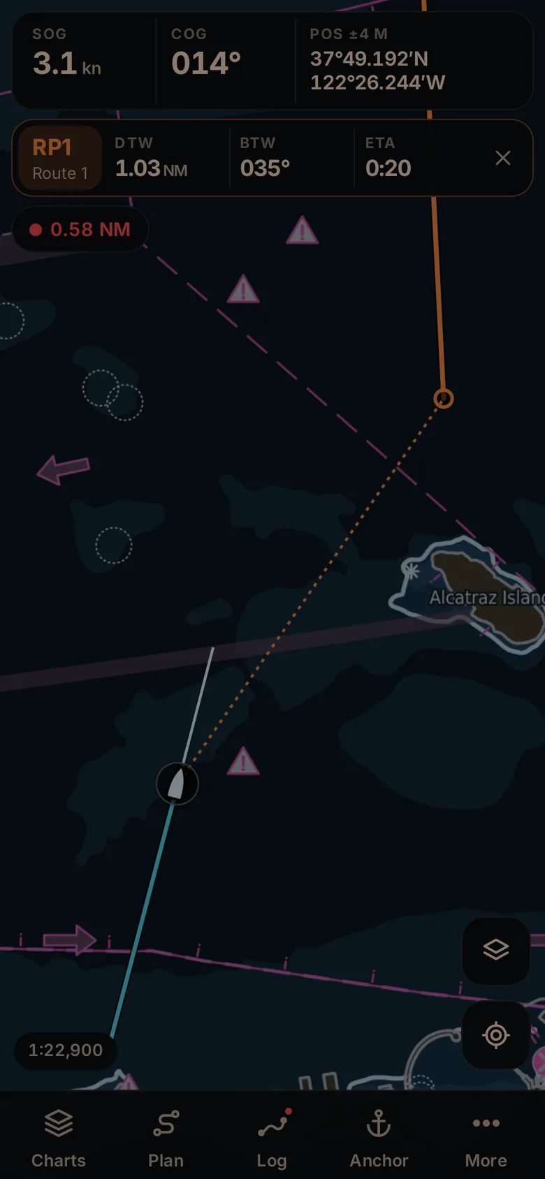
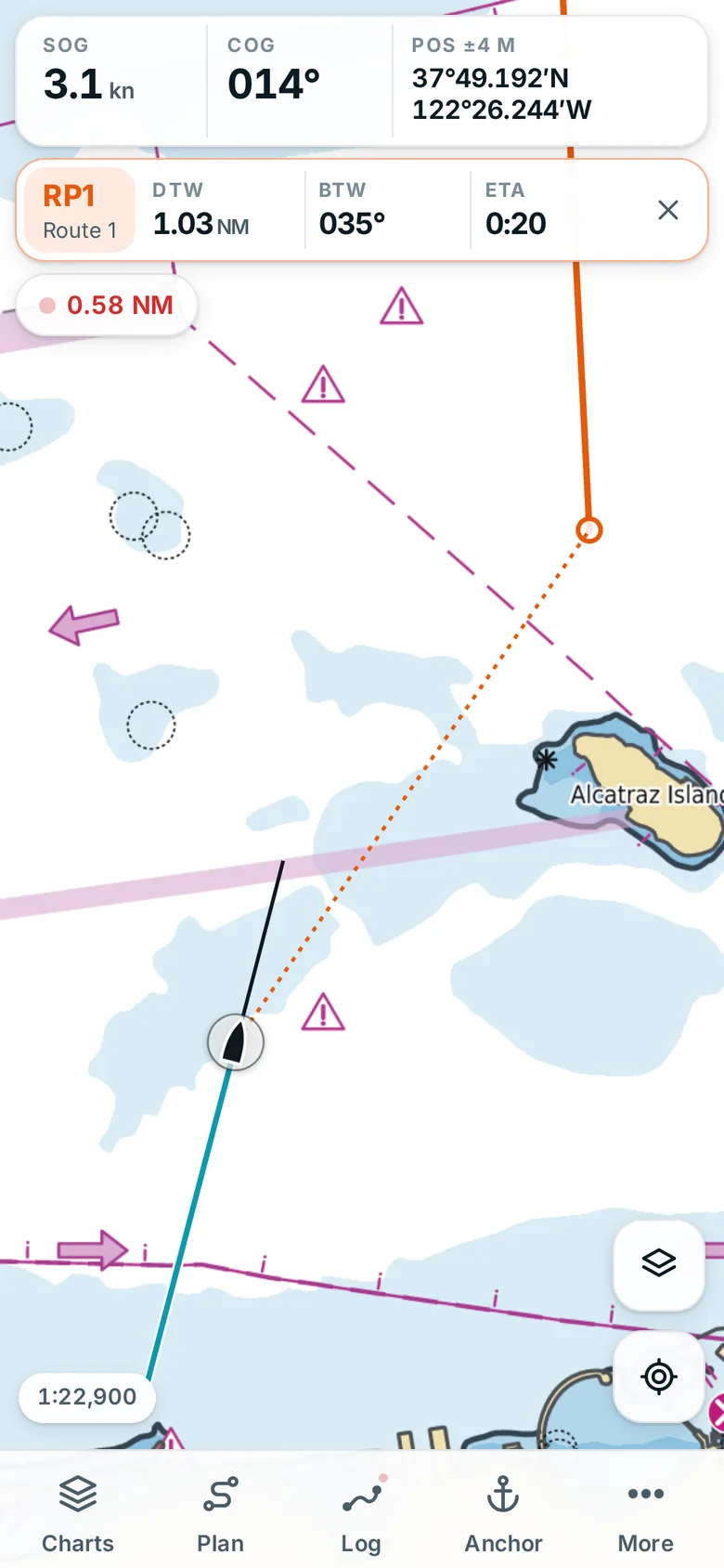
Routes and navigation
Tap out a route, drag its points, follow it. Distance and bearing to the next mark, cross-track error and ETA, with automatic leg switching.
 NautiNerd
Open the app
Offline marine charts
NautiNerd draws official nautical charts on your phone, with its own chart engine. Plan a route, follow it with cross-track error and ETA, log your passage and keep an anchor watch that wakes you when the boat drags. No account, no signal needed at sea.
Free official charts where governments publish them: US coasts and rivers, the inland waterways of eleven European countries, Brazil and Norway. Chart files (S-57, BSB/KAP) from any hydrographic office, and an unofficial sea map for everywhere else.
Get charts
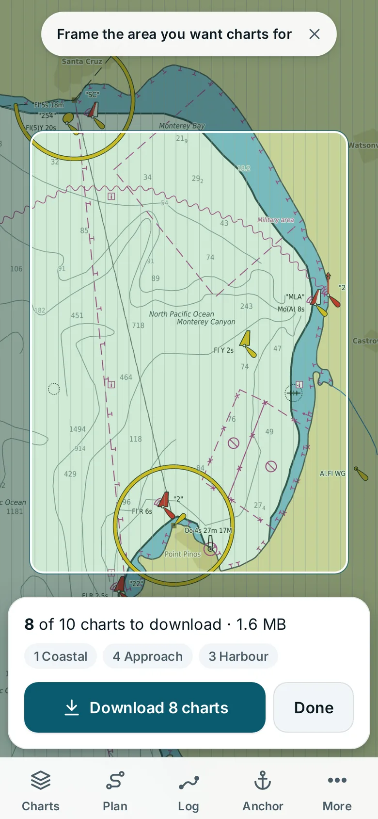
Move the map to your cruising ground and NautiNerd shows which official charts cover it, from overview to harbour detail, with their size: NOAA and the US Army Corps of Engineers, the inland waterway authorities from the Rhine to the Danube delta, Brazil's Navy and Norway's Kartverket. One tap downloads them for good; when corrections are published, the app tells you and updates them.
Anchor watch
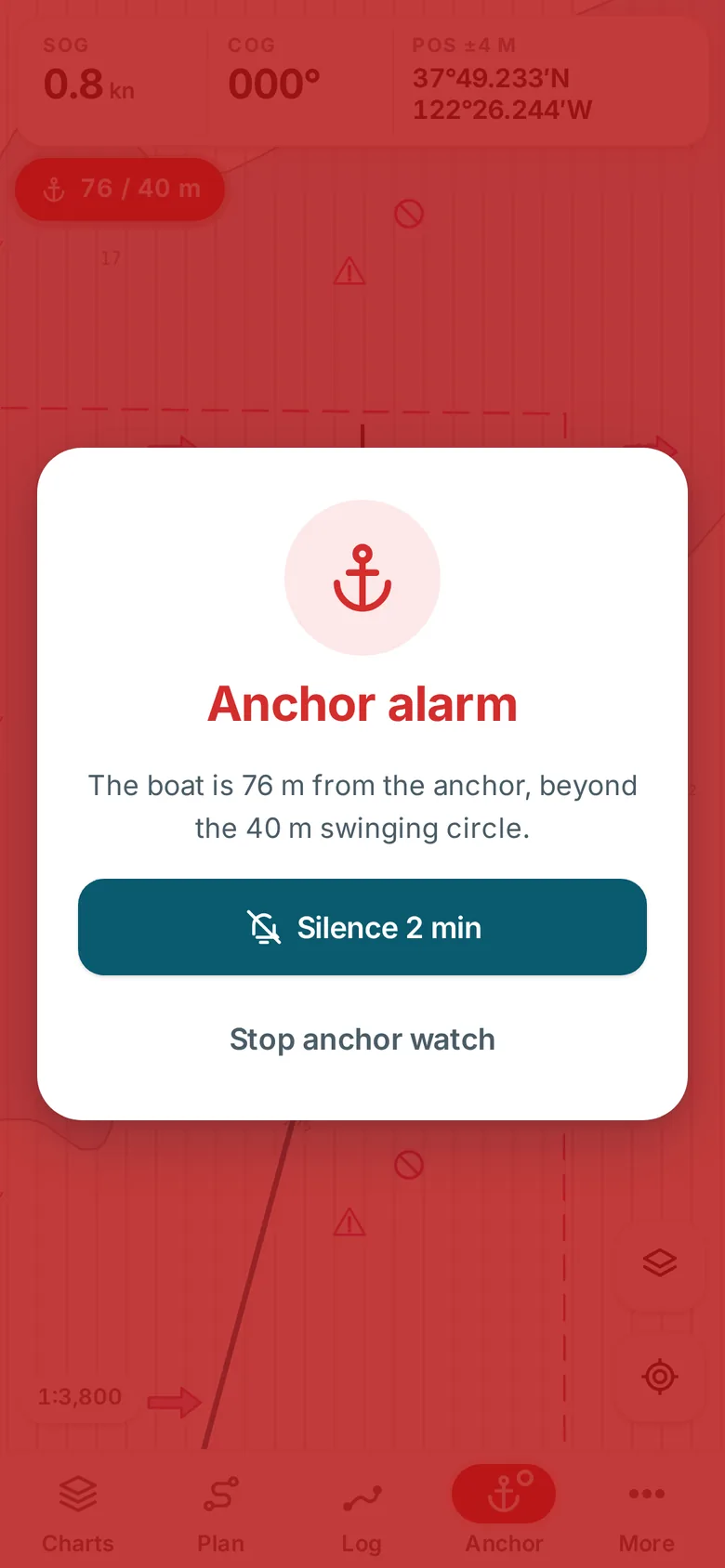
Drop anchor, set the swinging circle and put the phone away. If the boat leaves the circle, the phone wakes up and sounds a loud alarm, even in silent mode and with the screen off. The watch survives restarts and shows how far you have swung.
Tap anything
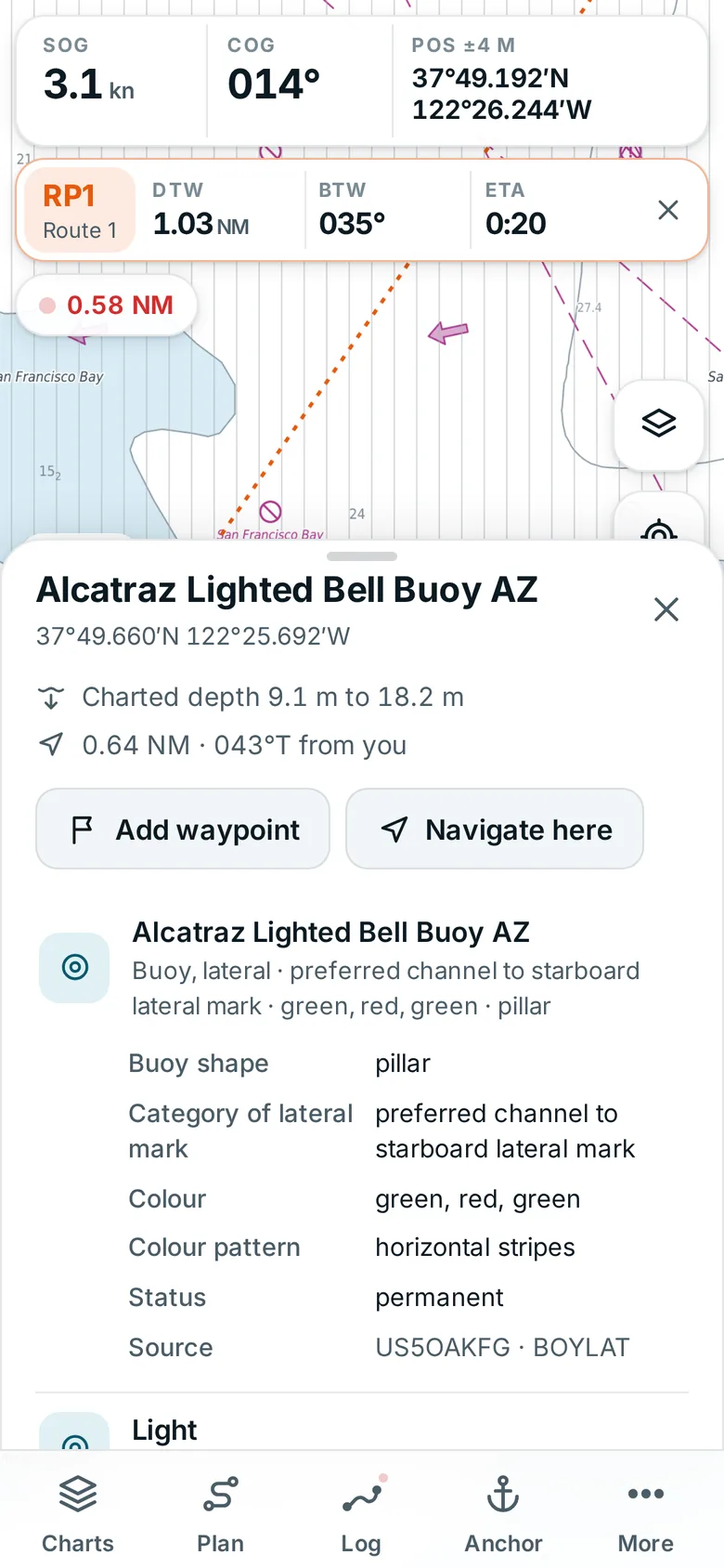
Tap a mark, a light or a wreck and read it in plain words: its light characteristic, its colours, the charted depth around it, how far it is from you. Hazards come first.
Sea map
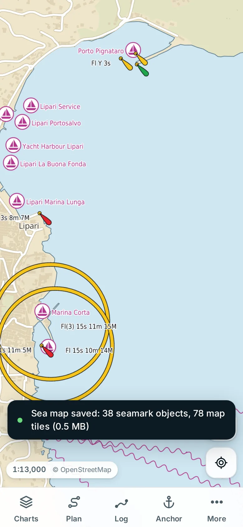
In much of the world official charts are encrypted and sold. NautiNerd saves a sea map for any area instead: seamarks from OpenStreetMap (and, in Finland, Norway and the Netherlands, the authorities' own open buoy, light and depth data) drawn with proper chart symbols, depth relief and a clean background map, ready offline. It is clearly marked as unofficial, and an official chart always takes over where you have one.
AIS and instruments
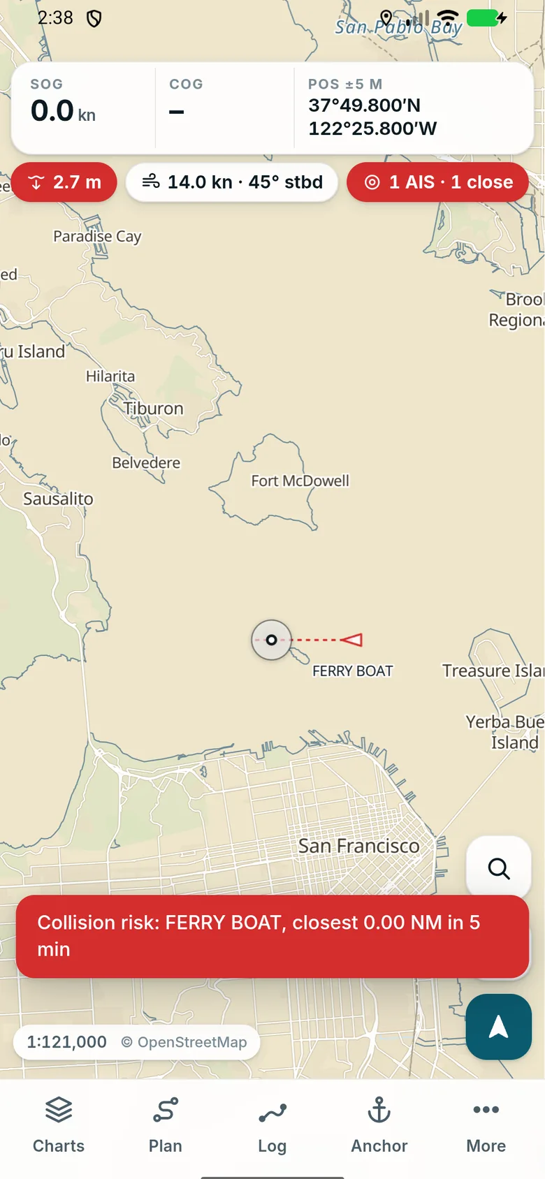
Connect NautiNerd to your boat's NMEA Wi-Fi gateway and the ships around you appear on the chart, with their course and a warning when one is set to pass too close. Depth and wind from your own instruments sit right under your speed and course.
Tap out a route, drag its points, follow it. Distance and bearing to the next mark, cross-track error and ETA, with automatic leg switching.
Record your passage in the background, see distance, time and speed, and share tracks as GPX.
Set your safety contour and depth; shallow water and isolated dangers are shaded and marked the way professional chart systems do it.
Day, dusk and night palettes for the chart and the app, with no bright whites in the cockpit at night.
Wind, gusts, pressure, rain, waves, swell and currents over the chart, animated, from ECMWF, GFS, ICON, AROME and more. Compare the models at any point and save the forecast for your passage.
Heights, high and low water and stream rates for nearly 9,000 stations worldwide, computed on your phone, offline.
Over 120,000 marinas, anchorages, moorings, fuel docks, slipways and boatyards on the chart, with VHF channels and contacts, and reviews from other sailors.
Add what you need to the dock: weather, tides, the guide, boat instruments and AIS. Leave out what you don't.
Charts, positions, tracks and routes stay on your device. An account is optional and only syncs your logbook between your devices. Usage is counted anonymously and without cookies; positions are never sent.
Under the hood
NautiNerd reads official electronic navigational charts (IHO S-57) directly and draws them by the S-52 display rules with an engine written from scratch in Rust, running on your device.
Runs in any modern browser on phones, tablets and computers. Install it to the home screen for offline use.
Open app.nautinerd.appKeeps tracking, navigating and watching your anchor with the screen off. Android 8 or newer.
Download APK (9.7 MB)Version 0.7.0 · SHA-256 d2521c93d1713dac1ffcb800228aafc61194235d07eede782694a045acf98ed6. Google Play listing coming.
The iPhone app is in the works. Until it is in the App Store, the web app works on iPhone and iPad.
Coming soonNautiNerd is not a certified ECDIS or type-approved navigation system. Use it alongside official charts, publications, a proper watch and your own judgement. Charts: NOAA Office of Coast Survey ENC® (public domain), U.S. Army Corps of Engineers, European inland waterway authorities (© WSV/ELWIS and others), Diretoria de Hidrografia e Navegação (Marinha do Brasil), © Kartverket; open data from Väylävirasto, Kystverket and Rijkswaterstaat. Background map © OpenStreetMap contributors. Weather: Open-Meteo.com (CC BY 4.0).